

“The Cairngorms National Park covers an area of 1,748 sq miles in the council areas of Aberdeenshire, Moray, Highland, Angus and Perth and Kinross. The mountain range of the Cairngorms lies at the heart of the national park, but forms only one part of it, alongside other hill ranges such as the Angus Glens and the Monadhliath, and lower areas like Strathspey and upper Deeside. Three major rivers rise in the park: the Spey the Dee and the Don. The Spey, which is the second longest river in Scotland, rises in the Monadhliath, whilst the Dee and the Don both rise in the Cairngorms themselves.
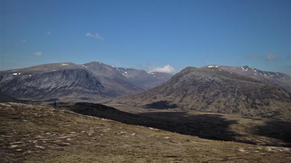
The Cairngorms themselves are a spectacular landscape, similar in appearance to the Hardangervidda National Park of Norway in having a large area of upland plateau.[citation needed] The range consists of three main plateaux at about 1000–1200 m above sea level, above which domed summits (the eroded stumps of once much higher mountains) rise to around 1300 m. Many of the summits have tors, free-standing rock outcrops that stand on top of the boulder-strewn landscape. The edges of the plateaux are in places steep cliffs of granite and they are excellent for skiing, rock climbing and ice climbing. The Cairngorms form an arctic-alpine mountain environment, with tundra-like characteristics and long-lasting snow patches.
The Monadhliath Mountains lie to the north of Strathspey, and comprise a bleak, wide plateau rising to between 700 and 950 m.
Two major transport routes run through the park, with both the A9 road and the Highland Main Line crossing over the Pass of Drumochter and running along Strathspey, providing links between the western and northern parts of the park and the cities of Perth and Inverness. The Highland Main Line is the only mainline rail route through the park, however there are several other major roads, including the A86, which links Strathspey to Fort William, and the A93, which links the Deeside area of the park to both Perth and Aberdeen.”
Wikipedia Page


If you are going to be here on the Saturday or Sunday prior to the conference (and are not involved in a Working Group or the Doctoral Consortium), you may want to wander around the City for an hour or two. Here are three different walks which take you around different parts of Aberdeen.


From the VisitAberdeenshire blog
Hillgoers owner, Garry Cormack shares his favourite hills and mountains in Aberdeenshire with VisitAberdeenshire.
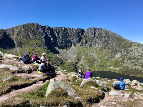
“I am often asked which hill is my favourite and I quickly respond, Lochnagar. It’s actually hard to choose between them, as most are good in their own way. Lochnagar has everything though, rich in history, wildlife, the plateau, Glas Allt Falls and the loch and the corrie itself are breathtakingly beautiful. You can walk up to the incorrectly named Munro summit of Lochnagar (on OS maps Cac Carn Beag, should probably be Cadha Carn Beag – the little steep of the stony hill) from a few approaches but the usual route up is from the Spittal of Glen Muick. There is also an excellent visitor centre at the Spittal.”
“The best view on the walk is the corrie itself, which can be seen from the col beside Meikle Pap and is a good enough walk just to go there.”
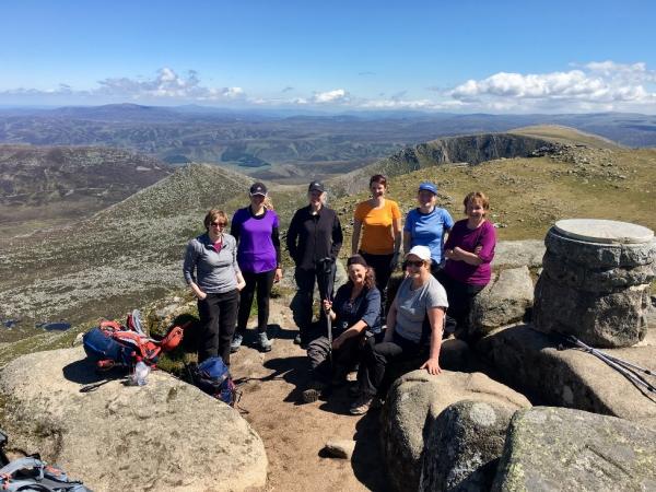
“You don’t have to be a Munro bagger to enjoy hills though and some of the smaller hills offer better views and more nature. Another favourite Aberdeenshire hill for me is of course Bennachie. I’m there quite often delivering navigation courses but also just to enjoy the walks. Bennachie has a good mix of woodland, moorland, path and stream junctions, perfect for teaching navigation. The views are great too, from the sea all the way into the Cairngorms National Park.”
“There is so much history on the hill, like the plane crash that saw the first recorded casualties of WW2, the magnificent iron age fort on Mither Tap, the old settlements below and the different quarries on the hill where stone was taken for the Thames embankment. My favourite way to enjoy the hill is to approach from the informative visitor centre. Walk along the Gordon Way then cut up to Oxen Craig, over Mither Tap then down the south path to Heather Brig, much easier on the knees. There are plenty of walks for all abilities, including diverse nature trails for the young and old. Have a look at the Bennachie Visitor Centre or Bailies of Bennachie website for more information.”
“Other favourites are Sgòr Mòr, a Corbett just up from Linn o’ Dee, which offers great views down the Lairig Ghru but anywhere in the Cairngorms is fantastic.”
“Other great smaller hills are Scolty Hill in Banchory, Carnferg in Aboyne, Craigendarroch above Ballater and the beautiful Creag Choinnich in Braemar which has a fantastic nature trail too.
Before you go up any hill you should let someone know where you are going, have the right equipment and have the skills to navigate your way around the hill. You should also know the code before you go too. You can always take an expert guide and let them take care of everything! As I tell my clients, hill walking is just walking, so take your time and enjoy it!”
Garry Cormack
Past Braemar, along the A93, at the edge of the Cairngorms, lies Glen Shee, the Glen of the Sith or Fairies.
Glen Shee is a glen in eastern Perthshire, Scotland. Shee. The head of the glen, where Gleann Taitneach and Glen Lochsie meet, is approximately 2 km north-west of the Spittal of Glenshee; it then runs south-east to Bridge of Cally where it merges with Strathardle to form Glen Ericht. Once known as the glen of the fairies it takes its name from the Gaelic “sith” meaning fairy and the old meeting place at the standing stone behind the present day church is called Dun Shith or Hill of the Fairies.
Wikipedia page
The main settlement is the Spittal of Glenshee, now by-passed, which has a historic hotel, first run by monks from Coupar Angus Abbey to provide shelter and hospitality for travellers, hence the name “Spittal”, an outdoor activity centre, self-catering lodges, the church and an original General Wade humpback bridge. The first record of a refuge for travellers there dates back to 961 AD.
At the Spittal, the Allt Lochay and Allt Beag join to form the Shee Water, which changes its name at Blacklunans to the Blackwater and eventually joins the River Ardle to form the River Ericht.
The A93 road, part of General Wade’s military road from Perth to Fort George, runs north through the glen and on into Glen Beag, where it crosses the Cairnwell Pass, at 2200 feet above sea level the highest public road in the UK. The road climbing to the summit is now wide and straight but until the late 1960s included two notorious hair-pin bends with a 1 in 3 (33%) gradient known as the Devil’s Elbow. One of the most spectacular roads in Scotland, this was a favourite subject for postcards.
From the VisitAberdeenshire blog
“Our 165 miles of stunning coastline, ancient fishing harbours and the rolling hills of purple clad countryside provide not only stunning backdrops but the perfect opportunity to discover nature.
VisitAberdeenshire blog
See puffins perching on craggy cliff-tops, seals chilling out on the beach bay, red deer roaming majestic countryside and even get up close to an eagle – can you believe that you can spot all of them in Aberdeen and Aberdeenshire?
No words can describe the beauty of the wildlife to be discovered here in North-east Scotland, so here’s some stunning images that do all the talking for us.:
“Braemar is a village in Aberdeenshire, Scotland, around 58 miles (93 km) west of Aberdeen in the Highlands. It is the closest significantly-sized settlement to the upper course of the River Dee sitting at an altitude of 339 metres (1,112 ft).
Wikipedia Page
The Gaelic Bràigh Mhàrr properly refers to the area of upper Marr (as it literally means), i.e. the area of Marr to the west of Aboyne, the village itself being Castleton of Braemar (Baile a’ Chaisteil).”

“Braemar is situated in the heart of the outstanding landscape of the Cairngorms National Park in the highest and most mountainous parish in the UK.
Surrounded by mountains, heather moorland, pine and birchwood, it spans the rocky gorge of the Clunie water. For generations, the scenery and pure mountain air have attracted visitors. They come to enjoy walking, climbing, wildlife watching, cycling, canoeing, fishing, stalking, golf and skiing. Within close proximity to over a quarter of Scotland’s Munro’s, the area has been the inspiration for countless writers, artists and photographers and many visitors return again and again.
A cohesive and supportive community of around 450 inhabitants, the village is known around the world for the annual Braemar Gathering. The event attracts around 15,000 people on the first Saturday in September each year and has the patronage of Her Majesty the Queen.
Braemar is situated on the tourist route from Perth to Aberdeen, which climbs over the Cairnwell Pass, the highest through road in the country and follows the River Dee along its picturesque valley. Surrounded by unspoilt and unpopulated countryside, it is however within an hour and a half’s drive of three major cities, Perth, Dundee and Aberdeen
Almost all Braemar is now a conservation area. The village is compact with a mix of grand Victorian houses, modest cottages, narrow roads and lanes and retains a unique character.”
BraemarScotland

From the VisitAberdeenshire blog
“Aberdeen and Aberdeenshire is well known for its granite buildings and sea transports links, but it also has a thriving arts and culture scene in addition to a rich and colourful history. Long sandy beaches lay adjacent to quaint fishing villages, city parks are nestled among some of the oldest buildings and structures in the UK.
VisitAberdeenshire blog
The region is home to world famous food, showcased through Michelin Guide restaurants just a short stroll from medieval castles and local ice cream producers like Mackie’s of Scotland putting North-east Scotland on the map as a top foodie destination.”

The Neolithic settlement of Skara Brae is one of the best preserved groups of prehistoric houses in Western Europe. It gives a remarkable picture of life 5,000 years ago, before Stonehenge was built.
The Neolithic village of Skara Brae was discovered in the winter of 1850. Wild storms ripped the grass from a high dune known as Skara Brae, beside the Bay of Skaill, and exposed an immense midden (refuse heap) and the ruins of ancient stone buildings. The discovery proved to be the best-preserved Neolithic village in northern Europe. And so it remains today.
Skara Brae was inhabited before the Egyptian pyramids were built, and flourished for centuries before construction began at Stonehenge. It is some 5,000 years old. But it is not its age alone that makes it so remarkable and so important. It is the degree to which it has been preserved. The structures of this semi-subterranean village survive in impressive condition. So, amazingly, does the furniture in the village houses. Nowhere else in northern Europe are we able to see such rich evidence of how our remote ancestors actually lived.
The profound importance of this remarkable site was given official recognition in 1999 when it was inscribed upon the World Heritage List as part of the Heart of Neolithic Orkney World Heritage Site.All the houses are well-built of closely-fitting flat stone slabs. They were set into large mounds of midden (household refuse) and linked by covered passages. Each house comprised a single room with a floor space of roughly 40sq m. The ‘fitted’ stone furniture within each room comprised a dresser, where prized objects were probably stored and displayed, two box-beds, a hearth centrally placed and small tanks set into the floor, perhaps for preparing fish bait.
A rich array of artefacts and ecofacts has been discovered during the various archaeological excavations. They include gaming dice, hand tools, pottery and jewellery (necklaces, beads, pendants and pins). Most remarkable are the richly carved stone objects, perhaps used in religious rituals. The villagers were farmers, hunters and fishermen, capable of producing items of beauty and sophistication with rudimentary technology. No weapons have been found and the settlement was not in a readily defended location, suggesting a peaceful life.
Most of the artefacts are now on view in the visitor centre, a short walk away.Village life appears to have ended around 2,500 BC. No one knows why. Some argue that it was because a huge sandstorm engulfed their houses, others that it was more gradual. As village life came to an end, new monuments were beginning to rise up on mainland Orkney, including most importantly the chambered tomb at Maes Howe and the impressive stone circles at the Ring of Brodgar and Stenness.isitors can explore this prehistoric village and see ancient homes fitted with stone beds, dressers and seats. A replica house allows visitors to explore its interior, while the visitor centre provides touch-screen presentations, fact-finding quizzes and an opportunity to see artefacts discovered during the archaeological excavations of the 1970s.
VisitScotland
Skara Brae – The Discovery and Excavation of Orkney’s finest Neolithic sites


